I spent a lot of time in the harbors and ports of California growing up. In fact, it was the formative firsthand experience of seeing competing uses for ocean and coastal resources that ultimately led me to this amazing California Sea Grant State Fellowship.
Until this year though, I never took a step back from the coastal California bubble that I called home my whole life to fully process the importance of the ocean access that ports and harbors provide. Maybe that’s what living in Sacramento will do to a sea slug. Maybe it’s the amazing network of inland but equally passionate coastal defenders that I’ve met here. Either way, my time as a fellow at State Lands Commission has put things into perspective and provided priceless insight, both professionally and personally.

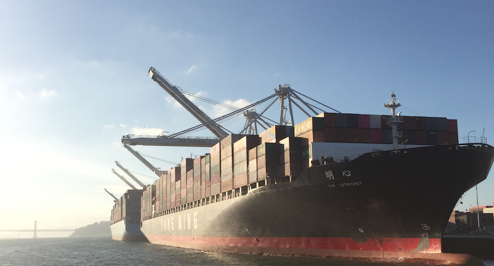
$1 Billion worth of goods flow through the Ports of Los Angeles and Long Beach every day. This is a photo from the Port of Oakland. Photo Credit: Sam Blakesley
The State Lands Commission is a self-described obscure but powerful agency that acts as the property manager on behalf of the state, leasing state property to “tenants” for public trust consistent purposes. Our jurisdiction is the underlying land between the mean high tide line on the coast, out to the state’s water boundary three nautical miles offshore. So, all those ports, harbors and piers built on California’s seafloor – you guessed it – must go through State Lands Commission for a lease. I sometimes tell people that the “State Submerged-Lands Commission” would be a more accurate name.
But what exactly does it mean to oversee the public trust? It means that we have a responsibility to balance the obligations of the public trust doctrine, a strong foundational law that upholds the public’s right to commerce, navigation, fisheries, recreation, and environmental stewardship on California’s waterways. No problem right, how hard could that be? And what might the implications of sea-level rise look like on top of all those activities?
Such are the questions I ask myself daily, while working with the State Lands Commission to proactively plan for the impacts of sea-level rise on granted public trust lands through the implementation of Assembly Bill 691. AB 691 requires that certain lessees of granted land (areas where the legislature has granted the day-to-day management authority to local jurisdictions like ports and harbors) are required to submit a sea-level rise vulnerability and adaptation assessment based on the same criteria.
The goal here is to understand:
- contextual and spatial differences,
- competing needs between grantees,
- common risks,
- priority assets,
- expected economic impacts, and
- preferred adaptation strategies among them.
My job is to help synthesize it all down to a comprehensive set of recommendations for the state to move adaptation forward.

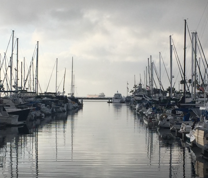
In this photo there are commerce, navigation, fishery, recreation and critical infrastructure concerns relating to the public trust doctrine. Environmental stewardship is where I come in. Photo Credit: Sam BlakesleyThe state has identified this need for a comprehensive sea-level rise adaptation approach in granted land areas not only because they contain critical infrastructure that provide critical functions and public services for the state and national economy, but they are quite literally our keys to the seas.
But how to do this when each port and harbor is unique and their challenges and responses to sea-level rise will be site-specific? How to deal with the fact that many of these state and local assets have very little capacity for relocation or retreat? Compounding these factors are the difficulties of scenario-based planning for what is still an abstract and largely unprecedented problem.
No one has the exact answer yet, and it’s important to remember there is no panacea to our problem of sea-level rise on these ocean portals. What I do know is that adaptive management and collaboration will be incredibly important, and if the brilliant people I’ve had the chance to work with throughout this fellowship are any indication, we are in good hands going forward.

This photo was taken after collecting a ballast water sample from the Shandong Hai Yao, and before analyzing the sample in the lab. Sea-level rise is not the only concern of harbors and ports. Photo Credit: Chris Scianni
All sea-level rise assessments were due on July 1, 2019 and will soon be made publicly available through the AB691 web page. Below are the broad next steps that we will be taking:
- Statewide cumulative evaluation study
- Vulnerability and adaptation report
- Financial cost estimate synthesis
- Recommendations to the state to support local adaptation implementation efforts
- Collaboration with federal, state, and local agencies
